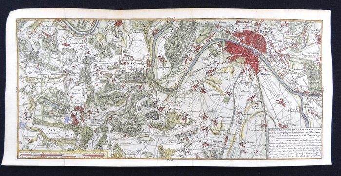
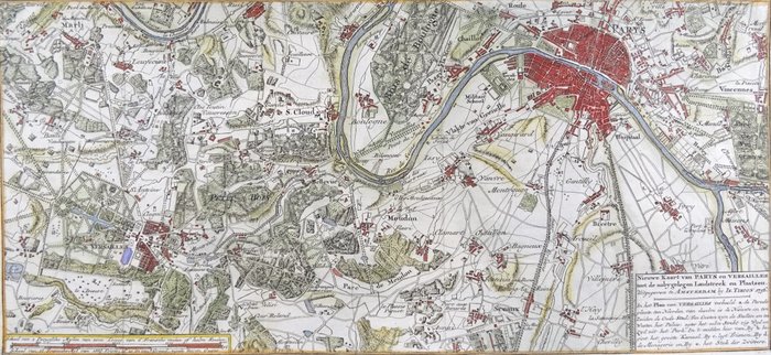
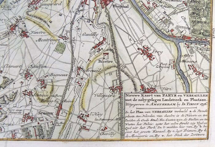
France, Paris, Versailles; Isaak Tirion - Nieuwe kaart van Parys en Versailles met de nabygelegen L
This advert is located in and around London, SPAIN
Currently displaying 1 of3 images
Advert Description
Are you interested in this item? This item is up for auction at Catawiki. Please click on "respond to advert" (orange button) to get redirected to the Catawiki website. Catawiki’s goal is to make special objects universally available. Our weekly auctions feature thousands of unusual, rare, and exceptional objects you won’t find in just any store. Nieuwe kaart van Parys en Versailles met de nabygelegen Landstreek en Plaatsen (…) (1757)
18th century copper engraved map, with a very high level of detail, of the area around Paris and Versailles.
Published by Isaak Tirion in Amsterdam (1757) in ´ Hedendaagsche historie, of Tegenwoordige staat van Frankryk..´.